Mission Command Overview
Real-time analytics and active risk assessments.
Active Alerts
New Disasters
People Saved (Est)
Success Rate
Affected Pop.
Critical Zones
D-SQUARE Intelligence
- High flood probability detected from rapid surface-water expansion in the Godavari basin.
- Landslide risk elevated due to soil moisture anomaly and slope instability in Western Ghats sector.
- Ground deformation pattern indicates elevated tectonic activity near the Himalayan fault line.
Top Priority Alerts
Flash Flood Warning
Zone: TN-Delta | 10 mins agoImminent Landslide
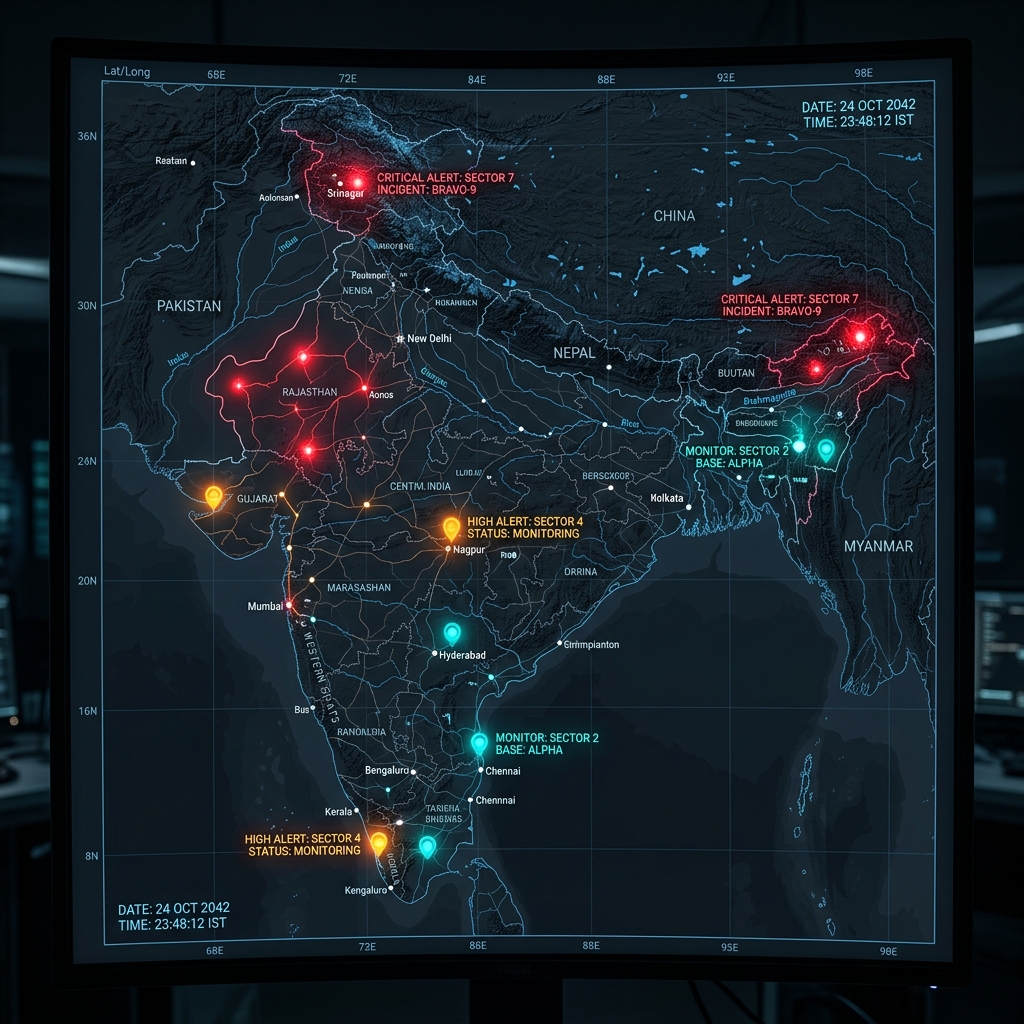
Zone: KL-Wayanad | 25 mins agoTactical Situation Map
Live topographical hazard mapping and deployment tracking.
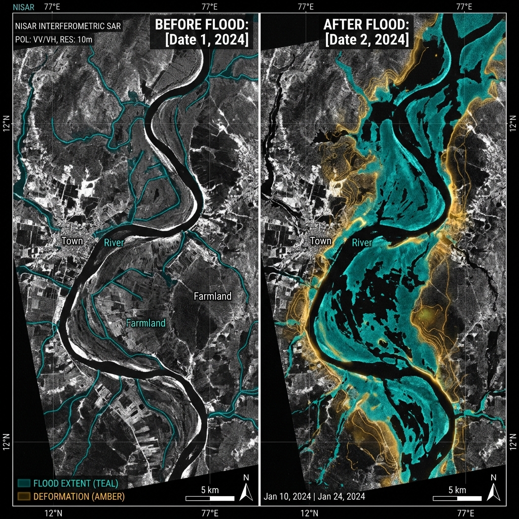
Orbital Telemetry (SAR)
Synthetic Aperture Radar analysis via dual-band (L & S) frequency.
Change Detection Scan
Live Sensor Data
AI Analysis: Extreme soil saturation detected correlating with 8% slope instability. Coherence tracking confirms pre-landslide signatures.
Ground Station Uplink
Direct terminal feed from NRSC Shadnagar and ISTRAC nodes.
Incident Command
Manage, verify, and broadcast actionable intelligence.
STATUS: NORMAL
All telemetry parameters are within safe thresholds. No immediate landslide risk detected.
Ooty - Coonoor Highway
Massive slope failure imminent due to supersaturated soil. Road blockage highly probable.
Brahmaputra Basin
River levels breached danger mark at 3 telemetry stations.
Citizen Response Module
Public-facing emergency toolkit and SOS beacon.
Emergency Instructions
- 1. Move to Higher Ground: Evacuate low-lying areas immediately.
- 2. Pack Essentials: Grab your 72-hour go-bag (water, meds, docs).
- 3. Disconnect Utilities: Turn off main power and gas lines.
Nearby Safe Zones
Analytics & Preparedness
Historical data and predictive modeling for resilience planning.
Warning Success Rate (YTD)
Significant improvement post D-SQUARE integration.
Preparedness Library
Post-Event Analysis
Deconstructing past events to improve future response.
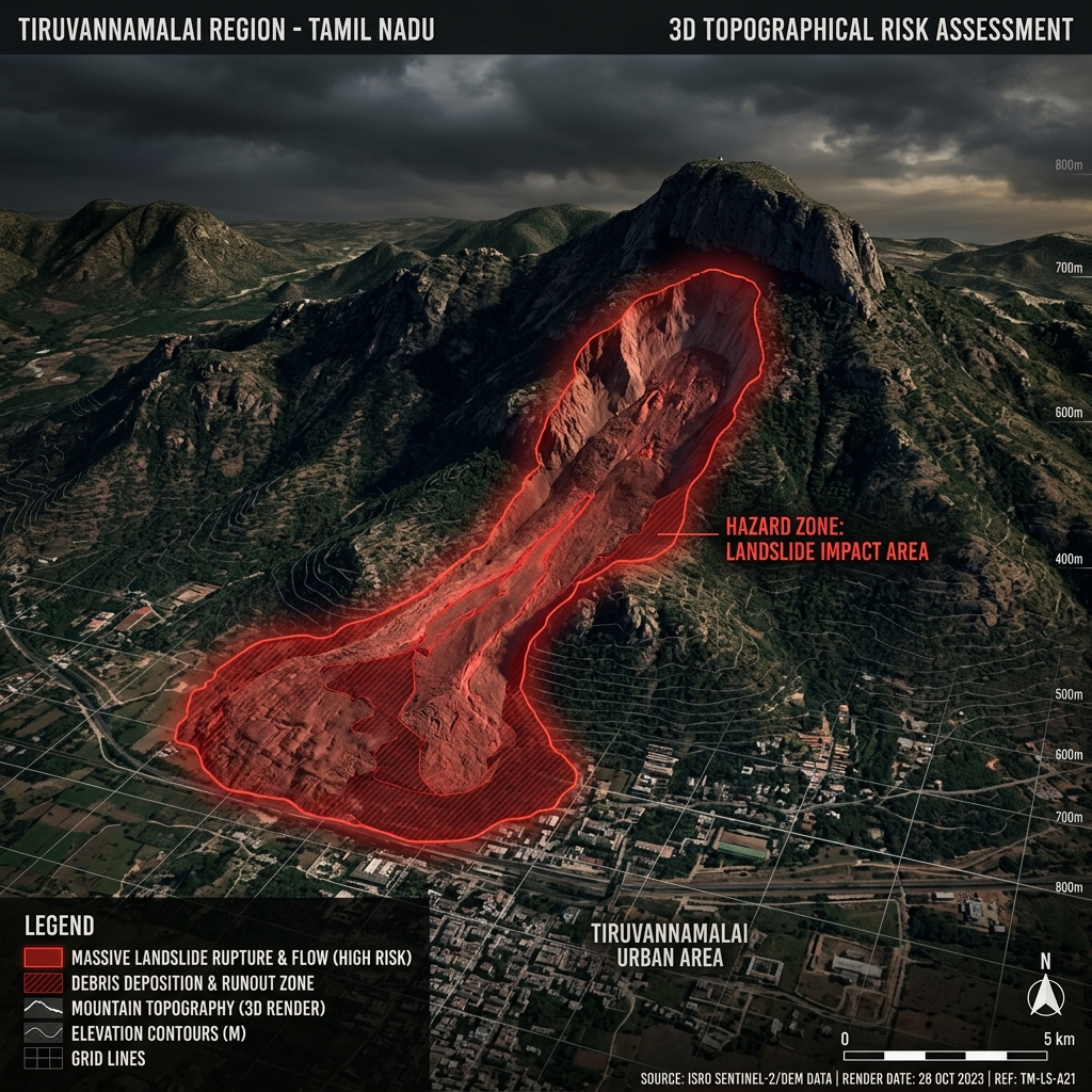
The Tiruvannamalai Tragedy
October 2024
In late 2024, an unexpected, massive landslide struck the slopes of Tiruvannamalai following unprecedented localized rainfall, tragically burying part of a settlement and claiming lives.
How D-SQUARE changes the outcome:
- Predictive Sensing: L-band SAR would have detected the millimeter-level ground deformation days before the collapse.
- Moisture Anomalies: Multispectral analysis would have flagged the extreme soil saturation beyond safe thresholds.
- Early Warning: Automated alerts sent 48 hours prior, providing sufficient window for mandatory evacuation.
"By translating invisible orbital data into actionable ground truth, D-SQUARE aims to ensure tragedies like Tiruvannamalai remain in the past."